Road Between Linkou and Taipei
Road Between Linkou and Taipei - Part I
Updated 12 January 2015 / Added 25 Jan 2004
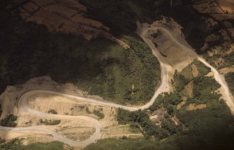
The famous road that snaked its way up the mountain to the Hill nobody will forget. It made for an interesting 30 to
40 minute trip by bus, especially during rainy and foggy conditions, which can be attested to by the following photos.


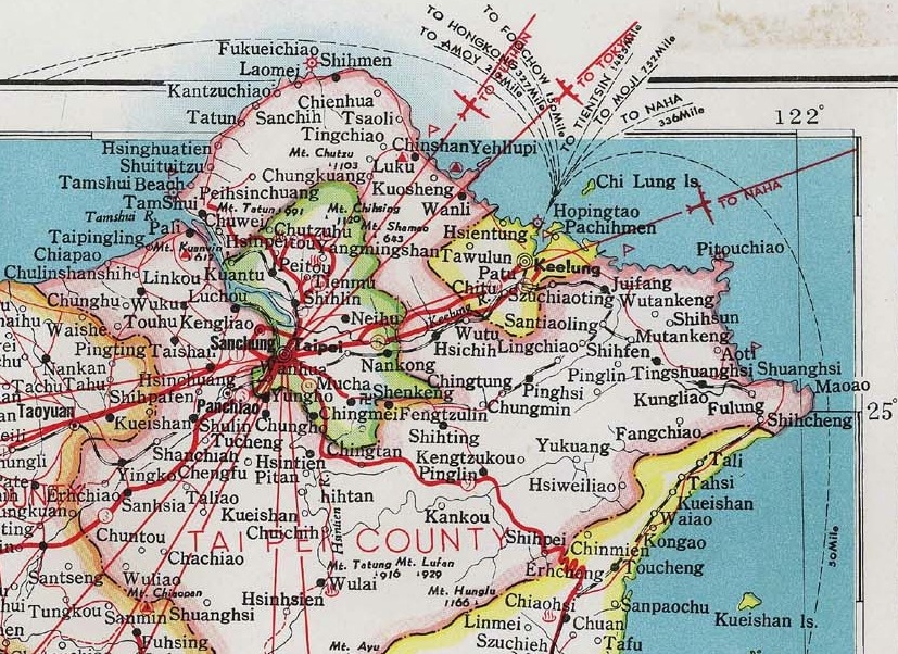
 1971 Taiwan & 1970 Taipei Maps, Nan Hua Publishing Co, Ltd., Taipei "Google Earth" 2007
(Click on Images to Enlarge-to "Zoom In" click again after opening)
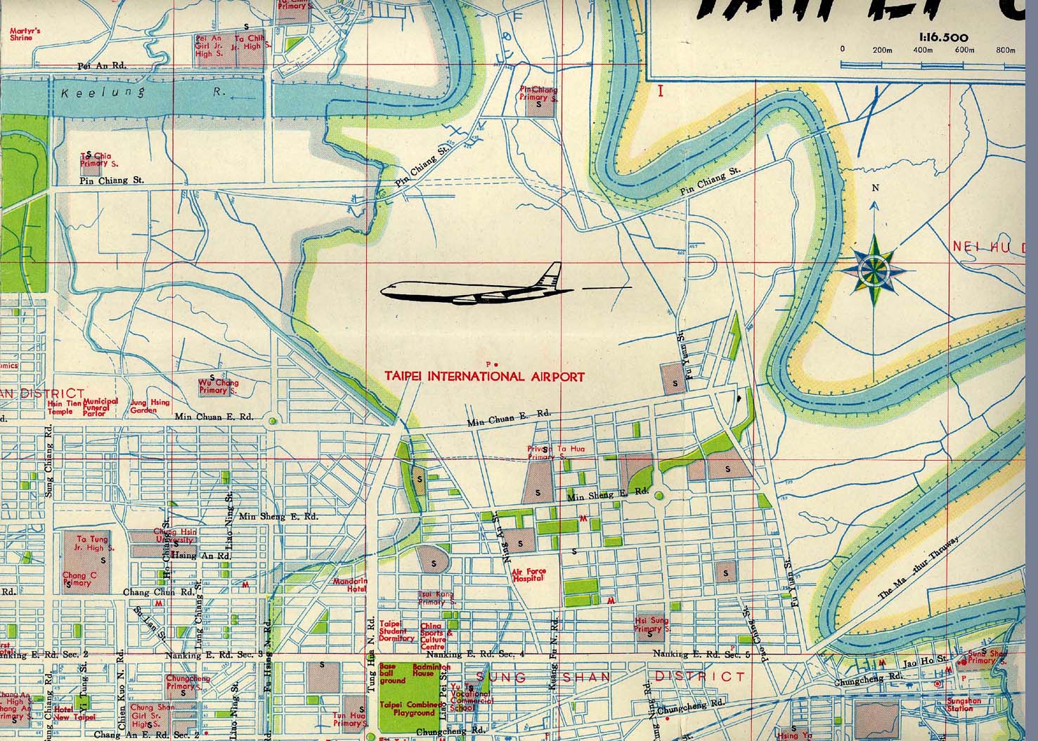
1971 Taiwan & 1970 Taipei Maps, Nan Hua Publishing Co, Ltd., Taipei "Google Earth" 2007
(Click on Images to Enlarge-to "Zoom In" click again after opening)
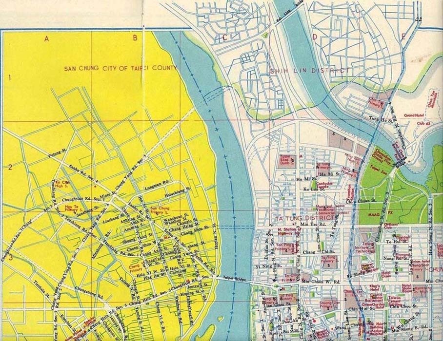
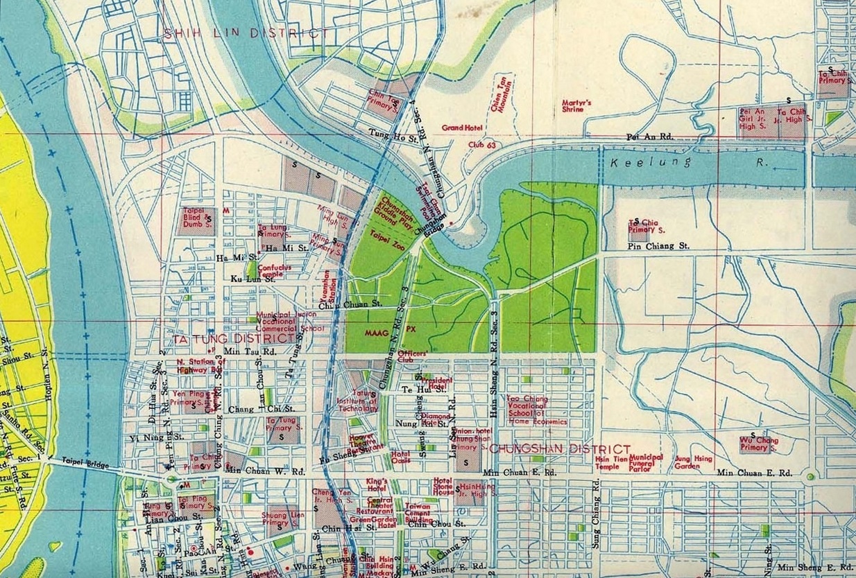
Linkou is located in the left center of the Taiwan map (far left.). The Taipei street map (second from left) shows Sanho Road that the Linkou bus followed to Taipei after the winding mountain road from Linkou. The bus crossed the Taipei Bridge and continued east on Min Chuan West Road. The bus then turned right onto Chungshan North Road and traveled a few blocks before stopping in front of the Suzie Wong Bar and OK bars and then the Linkou Club to discharge the Dawgs.
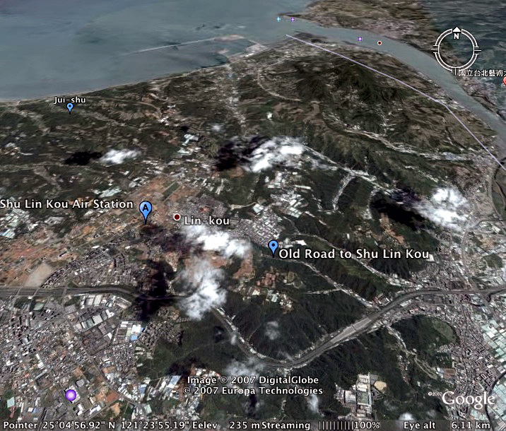
The 2007 satellite image ("Google Earth") above shows the location of Shulinkou AS, Ho Keng site ("Jui-Shu"), Linkou village, old Linkou road, Taipei (lower right), Kuan Yin Mountain (elev. 2000 ft.), Tamshui River (upper right), and the South China Sea coastline.
Linkou Road 1957 to 1959


 Photo credits: (1.) Col Robert Stark (2.) Tom Jones (1957-58) (3.) Shulinkou Devil Dog base newspaper, Feb. 23, 1977 edit, provided by Roger Jarvis (1975-77)
(Click on Photos to Enlarge)
Photo credits: (1.) Col Robert Stark (2.) Tom Jones (1957-58) (3.) Shulinkou Devil Dog base newspaper, Feb. 23, 1977 edit, provided by Roger Jarvis (1975-77)
(Click on Photos to Enlarge)
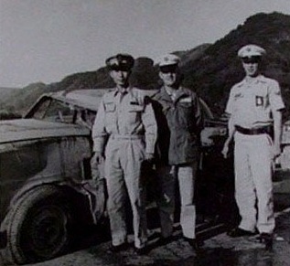
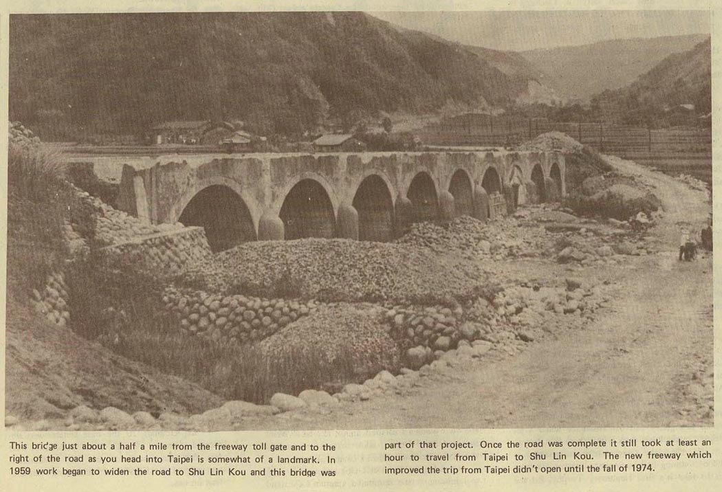
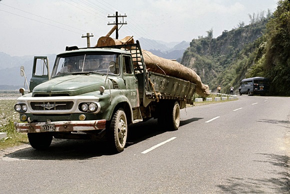
(1.) Circa 1957 shot of a ChiNat Army officer and Linkou Air Police next to a car that went over the side of the treacherous mountain road to Linkou. (2.) 1959 shot showing the road construction and paving on winding Linkou Road. The road construction was completed about 1960. (3.) 1959 bridge construction in conjunction with widening and paving the road to Shulinkou.
Alan Zeliff (Shulinkou: 1958-60): "...The shuttle down to the MAAG compound [in 1958 and 1959] was great fun too. We rode in open trucks called six-bys driven by Chinat drivers. The road was unpaved and we sped along, bouncing from rock to rock, past the adjacent Chinat army base, the village of Linkou and down the switchbacks to the main road to Taipei. By the time we got to Taipei we were filthy from all the road dust. Before I left for the US and my discharge in 1960, they did pave the road (see photos above) and what a difference that made. We even got to ride in buses after that." [27 Oct 2010]
Linkou Road 1960s and 1970s
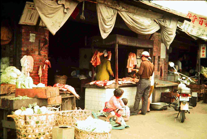 1970 photos by Jack Boex
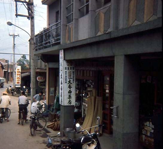
A couple of miles from base we passed through the village of Linkou. Shown is a local meat market (right).
1970 photos by Jack Boex
A couple of miles from base we passed through the village of Linkou. Shown is a local meat market (right).
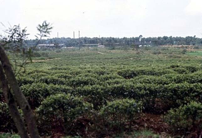
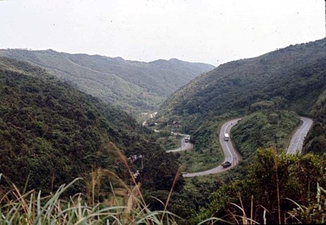 1970 photos by Loyd Harris
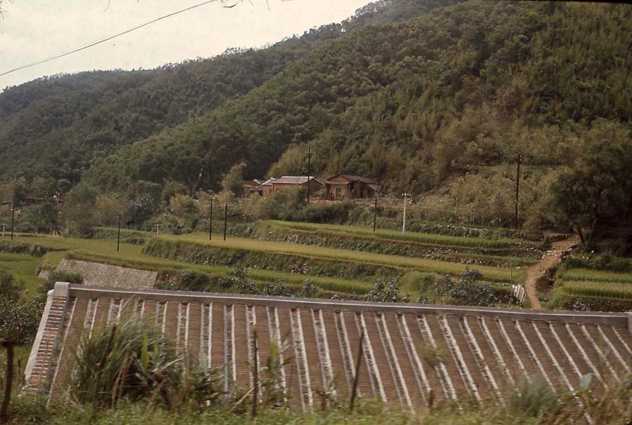
(Left photo) Shulinkou was surrounded by tea plantations like above. They were a common site outside the Main Gate.
1970 photos by Loyd Harris
(Left photo) Shulinkou was surrounded by tea plantations like above. They were a common site outside the Main Gate.
(Right photo) A view of the winding road below to Taipei.
 (Left photo) Neil Stackhouse, courtesy of "6987thAlumni Association.org" (Right photo) Mike Hine
(Left photo) 1972/73 shot of the blue Linkou Bus ahead in the distance while traveling via auto from Linkou to Taipei on the winding Linkou road.
(Left photo) Neil Stackhouse, courtesy of "6987thAlumni Association.org" (Right photo) Mike Hine
(Left photo) 1972/73 shot of the blue Linkou Bus ahead in the distance while traveling via auto from Linkou to Taipei on the winding Linkou road.
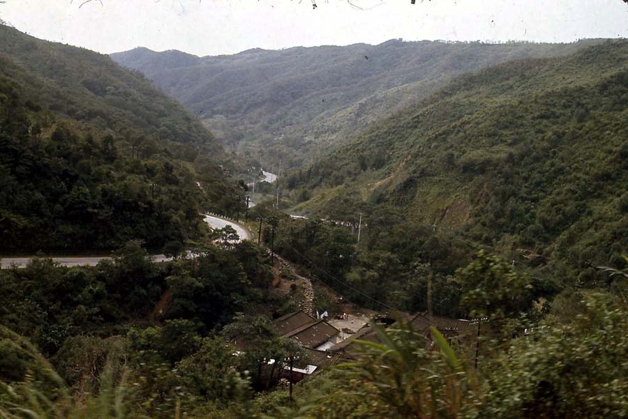
(Right photo) View of the narrow and winding road to Taipei and Linkou looking down the mountain from the bus.
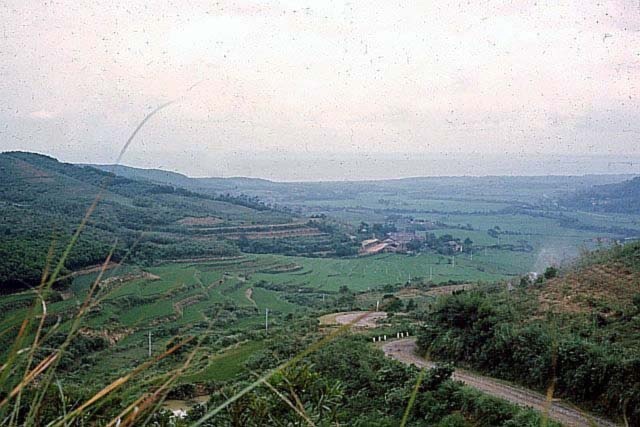
 1970 photos by Mike Hine
1970 shots fom the Linkou bus window as it reached the bottom of the mountain and the flatlands to Taipei.
1970 photos by Mike Hine
1970 shots fom the Linkou bus window as it reached the bottom of the mountain and the flatlands to Taipei.
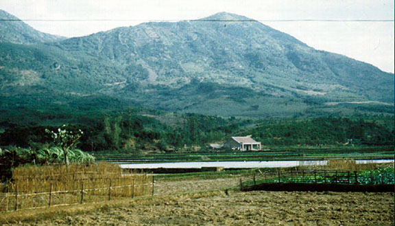
 1966 photos by Tony Gross (left) and Paul Harris (Dawg Flight 1966) courtesy of "6987thalumniassociation.org"
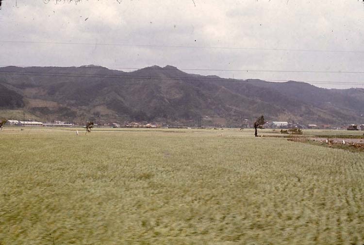
These were the views from the Linkou bus heading back up the Hill from Taipei. Rice paddies are shown along the winding road and in the background. Upon reaching the base
1966 photos by Tony Gross (left) and Paul Harris (Dawg Flight 1966) courtesy of "6987thalumniassociation.org"
These were the views from the Linkou bus heading back up the Hill from Taipei. Rice paddies are shown along the winding road and in the background. Upon reaching the base
of the mountain, the road climbed to the top with a series of switchbacks. A portion of these switchbacks are visible half way up the mountain in the center of the left photo.
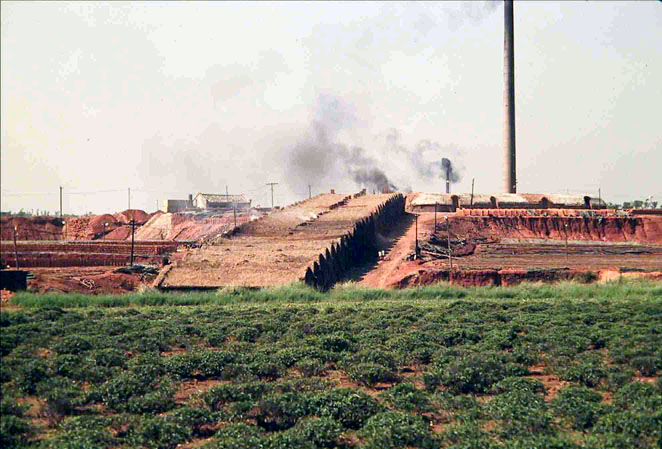
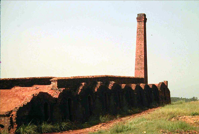 1970 photos by Carpenter
A brick factory located along the road to Taipei with a tea field in the foreground. This
1970 photos by Carpenter
A brick factory located along the road to Taipei with a tea field in the foreground. This
was a very important industry needed for Taipei's rapid growth and building construction.
 photos by N. Carpenter and J. Hansen
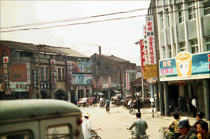
(Left) 1970 view out the Linkou bus window of a small, crowded suburb of Taipei near the right hand turn the bus took at the base of the mountain.
photos by N. Carpenter and J. Hansen
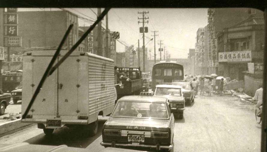
(Left) 1970 view out the Linkou bus window of a small, crowded suburb of Taipei near the right hand turn the bus took at the base of the mountain.
(Right) 1971 view through the Linkou Bus windshield of the "uncontrolled chaos" ahead in the outskirts of Taipei approaching the city.
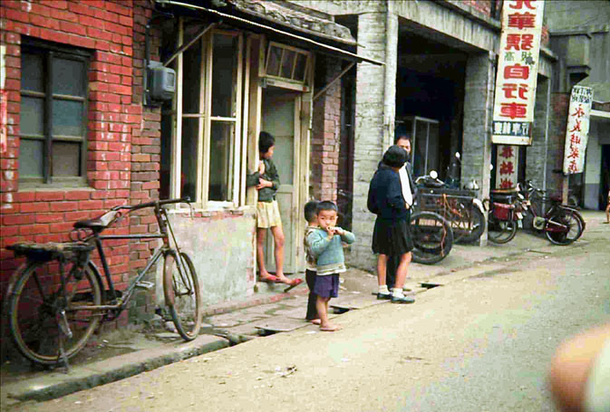
 1970 photos by M. Hine
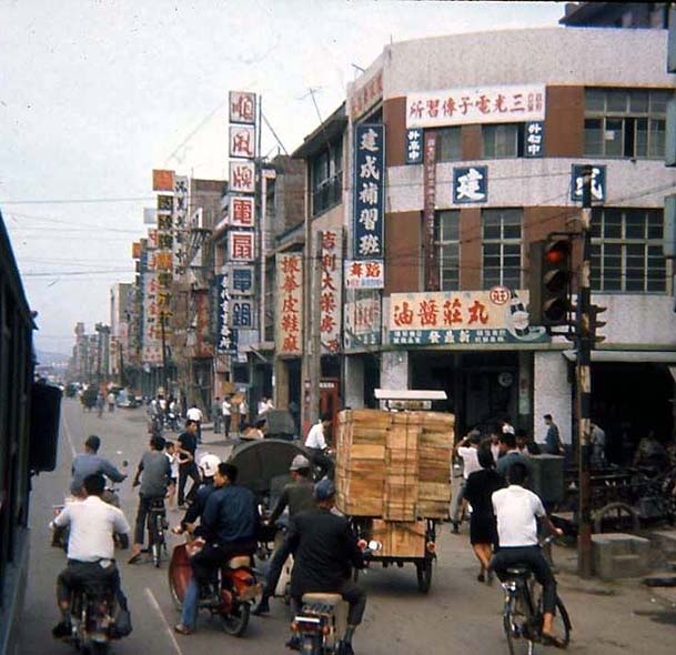
1970 views from the Linkou bus window of the shops and heavy traffic entering the outskirts of Taipei.
1970 photos by M. Hine
1970 views from the Linkou bus window of the shops and heavy traffic entering the outskirts of Taipei.
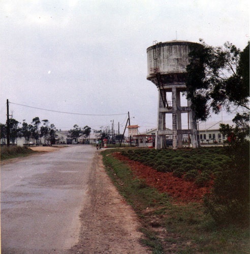 1970 photo by Larry Johnson (NSG) courtesy of "LinkouNavy.com"
The familiar view of the Main Gate (center), tea field (right) and old water tower from Linkou Road as we returned to base
1970 photo by Larry Johnson (NSG) courtesy of "LinkouNavy.com"
The familiar view of the Main Gate (center), tea field (right) and old water tower from Linkou Road as we returned to base
from Taipei. Visible in the photo are Headquarters (far right), Theater (behind water tower) and the Linkou Club (left-center).
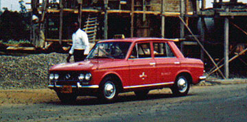 1966 photo by Tony Gross
At the end of another Mid, Swing or Day Watch, Dawgs often hailed a "Huey Long" taxi (1966 YLN Datsun Bluebird pictured) waiting right outside the Linkou Main Gate, for a fast 20 minute ride down the hill to Taipei. The Dawgs often took a taxi (40 NT and 5 NT for the toll bridge or $1.13 U.S. total) in lieu of the AF shuttle bus because it was much faster and gave them more "quality" time in town! "Zuo Bian, Panyo! Taipei...Kuai De-Kuai De...!!!"